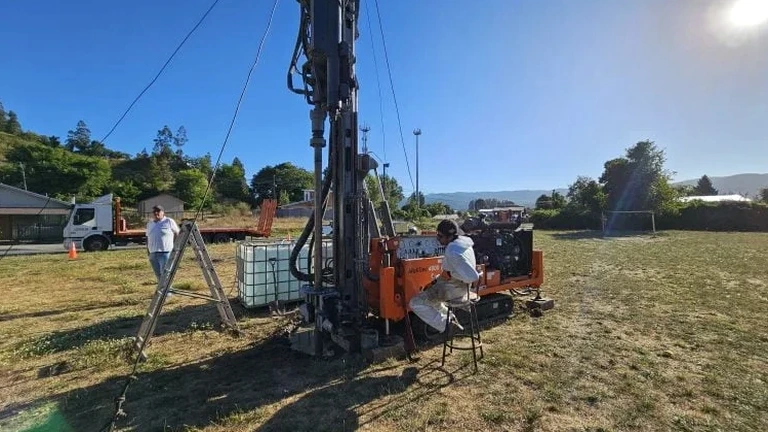
The Ontario Building Code and the local amendments enforced by the City of Markham demand a clear picture of the subsurface before any foundation design can be finalized. In our experience, the glacial till and silty sand deposits across the Rouge River watershed create variable conditions that standard drilling alone can miss. An exploratory test pit lets our team walk into the excavation, map the stratigraphy directly, and collect undisturbed samples from the precise depth of interest. When an excavation touches the water table in the Don River plain or uncovers buried organics near the Oak Ridges Moraine, having that visual confirmation changes the engineering approach. For projects that require a deeper understanding of the soil profile before mobilization, we often combine the pit data with a CPT test to extend the investigation depth without losing the tactile verification that the pit provides.
A single test pit in the Halton Till can reveal more about the depositional history than three boreholes spaced fifty meters apart.
Process and scope
Last fall, a commercial build on Woodbine Avenue sat on a parcel that historical fill maps had flagged as reclaimed. The geotechnical report called for a test pit to verify the fill thickness and to check for debris that could deflect a helical pile. Our crew opened a 4.2-meter pit through mixed clay and brick fragments, logged the contact with the intact Halton Till, and extracted block samples for the lab. That single day of work saved the owner a costly redesign because we caught a pocket of organic silt that the borehole log had averaged out. In Markham, the subsurface often shifts from stiff clay to running sand over a span of thirty meters, and these pits let us react in real time. The process follows the procedures outlined in CSA A23.3 for concrete exposure classification and the field logging protocols of ASTM D2488, ensuring that every description is repeatable and defensible.
Local ground factors
The freeze-thaw cycles in York Region create a risk profile that is different from what you would see further south on the lakeshore. When a test pit stays open overnight in March, the exposed clay face can spall and soften, which alters the moisture content reading and can lead to an overestimated bearing capacity. In the summer, on the other hand, a pit dug through the dry crust near Major Mackenzie Drive can look competent in the morning and start sloughing by noon if the humidity drops and the silt loses apparent cohesion. Our field leads keep a log of weather conditions during each pit investigation because a rain event or a sudden thaw changes the soil behavior enough to affect the engineering parameters. We also watch for the region's perched water tables: a pit that is dry at three meters can fill half a meter of water in two hours if the excavation intersects a silt lens that drains the surrounding slopes, and that water inflow has to be noted because it impacts the effective stress calculation for the foundation.
Frequently asked questions
What is the typical cost range for an exploratory test pit in Markham?
For a standard test pit in the Markham area, the cost usually falls between CA$610 and CA$1,170 per pit. The final figure depends on depth, whether shoring is required, the number of samples collected, and the distance from our staging yard. If the pit has to be opened inside a structure or in a confined space, the safety setup adds to the total.
How deep can you excavate a test pit in the clay soils around Highway 7?
We typically reach 3.0 to 4.5 meters with a compact excavator before the bucket becomes inefficient. Deeper than that, the pit enters the zone where O.Reg. 213/91 mandates engineered shoring, and we will either install a trench box or switch to a borehole method. The Halton Till in the Highway 7 corridor is stiff enough that a 3.5-meter vertical face can stand for several hours in dry weather.
Do you need a permit to open a test pit on private property in Markham?
On private property, the excavation itself does not usually require a separate City of Markham permit as long as it is part of a geotechnical investigation tied to a building permit application. Utility locates are mandatory, and we file the locate request with Ontario One Call at least five business days before breaking ground. If the pit is in the public right-of-way, a road occupancy permit is required.
How does a test pit compare to a borehole when the water table is high?
A test pit gives you a direct view of the seepage face, which a borehole log can only infer from the drilling fluid return. In the low-lying areas near the Rouge River, we often see water entering the pit through sand stringers that a split-spoon sample would have missed. The downside is that the pit bottom can become unstable quickly, so we complete the logging and sampling fast and then backfill. For a continuous profile below the water table, we complement the pit with a CPT sounding or a mud-rotary borehole.