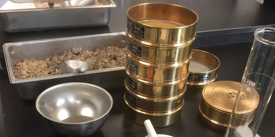
Compliance with the Ontario Building Code (OBC) and CSA A23.3 starts with knowing exactly what you're building on, and in Markham, that means dealing with the glacial legacy of the Oak Ridges Moraine. The grain size distribution of your subsoil directly governs drainage, frost susceptibility, and bearing capacity. Our laboratory performs combined sieve and hydrometer testing following ASTM D422 to classify materials from the coarse sands of the Rouge River valley to the silty clays found near Highway 7. When developers are placing deep footings in the Don River watershed, a precise particle-size curve becomes the first line of defense against differential settlement claims. We often pair this test with an Atterberg limits analysis to fully define the fines fraction, giving you a complete picture before compaction or foundation design begins.
A complete gradation curve from 75 mm down to 2 microns is the difference between a foundation that performs for 50 years and one that needs remediation after the first spring thaw.
Frequently asked questions
What's the cost for a full sieve and hydrometer test in Markham?
A complete combined sieve and hydrometer analysis typically runs between CA$140 and CA$270 per sample, depending on whether we need to run the full hydrometer sedimentation curve or just a wash-sieve for fines content. Volume pricing applies for multi-sample projects.
How do I take a representative sample for grain size analysis?
The sample must be at least 500 g for fine-grained soils and up to 5 kg if gravel is present. It should be sealed immediately in a plastic bag to preserve natural moisture. We can provide sampling containers and guidance for your site in Markham.
Why do I need both sieve and hydrometer testing?
The sieve analysis covers particles down to 75 microns, but the hydrometer extends that to 2 microns to capture the clay fraction. In Markham's glacial soils, this clay percentage is what controls frost heave potential and long-term settlement behavior under load.
How do you classify a soil from the grain size curve?
We use ASTM D2487 (Unified Soil Classification System), which combines the grain size distribution with the Atterberg limits. The percentages of gravel, sand, silt, and clay, along with the D60, D30, and D10 values, determine whether the soil is a well-graded sand (SW), lean clay (CL), or another classification.